University of Minnesota
http://www.umn.edu/
612-625-5000
http://www.umn.edu/
612-625-5000
Minnesota Biodiversity Atlas
Bell Museum
Dataset: MIN-Bryophytes
Search Criteria: Papua New Guinea; Eastern Highlands; excluding cultivated/captive occurrences
1
Page 1, records 1-12 of 12
Bell Museum bryophytes | |
 MIN:Bryophytes | 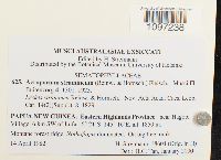 Acroporium stramineum (Reinw. & Hornsch.) M. Fleisch. 876131[1097238]H. Streimann 186041982-04-14 Papua New Guinea, Eastern Highlands, near Hagobi Village, 6 km SW of Lufa, -6.35 145.26667, 1850m |
MIN:Bryophytes | 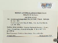 864085[1097184]H. Streimnann 183391982-04-10 Papua New Guinea, Eastern Highlands, Wopeia, Aiyura-Oniara Road, 10 km SE of Aiyura, -6.33333 145.91667, 1550m |
MIN:Bryophytes | 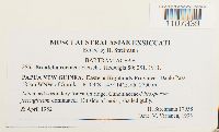 Breutelia roemeri M. Fleisch. 876045[1107339]H. Streimann 179581982-04-00 Papua New Guinea, Eastern Highlands, Daulo Pass, 18 km WNW of Goroka, -6.05 145.23333, 2700m |
MIN:Bryophytes | 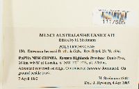 Dawsonia beccarii Broth. & Geh. 864311[1117585]Heinar Streimann 180811982-04-04 PAPUA NEW GUINEA, Eastern Highlands, Daulo Pass, 18 km WNW of Goroka, -6.83333 145.23333, 2700m |
MIN:Bryophytes |  Macromitrium semperi Müll. Hal. 831318[1140718]Streimann, H. 180941982-04-07 Papua New Guinea, Eastern Highlands, Daulo Pass, 18km WNW of Goroka, -6.833333 145.75, 2600m |
MIN:Bryophytes |  Mesonodon flavescens (Hook.) W.R. Buck 831317[1140930]Streimann, H. 182731982-04-09 Papua New Guinea, Eastern Highlands, Lapegu Forestry Station, 6km SW of Goroka, -6.1 145.333333, 1520m |
MIN:Bryophytes | 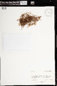 972227[1373275]Weber, W. A. B-319291968-07-26 Papua New Guinea, Eastern Highlands, Bismarck Ranges; Mount Wilhelm; steep slope of Imbuka Ridge above Lake Aunde., 3658m |
MIN:Bryophytes | 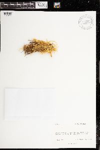 972228[1373276]Weber, W. A. B-321241968-07-03 Papua New Guinea, Eastern Highlands, Bismarck Ranges, Mount Wilhelm; Imbuka Ridge above Lake Aunde, 3658m |
MIN:Bryophytes | 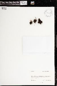 972230[1373278]Weber, W. A. B-321391968-06-27 Papua New Guinea, Eastern Highlands, Bismarck Ranges; Mount Wilhelm; shore of Lake Aunde at base of Imbuka Ridge., 3505m |
MIN:Bryophytes | 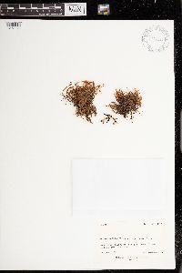 972231[1373279]Weber, W. A. B-321701968-06-26 Papua New Guinea, Eastern Highlands, Bismarck Mountains, Mt. Wilhelm, Imbuka Ridge above Lake Aunde., 3505m |
MIN:Bryophytes | 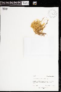 Brachythecium glareosum (Bruch ex Spruce) Schimp. 972181[1373297]Weber, W. A. B-320051968-07-03 Papua New Guinea, Eastern Highlands, Bismarck Ranges, Mount Wilhelm; Imbuka Ridge above Lake Aunde, 3658m |
MIN:Bryophytes | 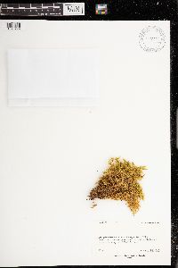 972226[1373274]Wade, L. K. 82891967-00-00 Papua New Guinea, Eastern Highlands, Bismark Ranges, vicinity Pindaunde Field Station, 3658m |
1
Page 1, records 1-12 of 12
Google Map
Google Maps is a web mapping service provided by Google that features a map that users can pan (by dragging the mouse) and zoom (by using the mouse wheel). Collection points are displayed as colored markers that when clicked on, displays the full information for that collection. When multiple species are queried (separated by semi-colons), different colored markers denote each individual species.